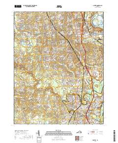
2019 Map of Chester
USGS Topo · Published 2019About this map
The community of Chester serves as the central hub of this survey, where the CSX rail line and major thoroughfares like Iron Bridge Rd converge. The landscape is defined by the winding course of Swift Creek and its many tributaries, including Timsbury Cr and Ashton Cr, which drain toward the Appomattox River and the historic James River Old Channel. To the east, the legacy of the Civil War is preserved within the Richmond National Battlefield Park near Farrar Island. Genealogists will find a high density of burial sites across the quadrangle, ranging from larger grounds like Sunset Memorial Park Cem to smaller family plots such as the Perdue Family Cem. The map also captures the suburban character of Colonial Heights and smaller settlements like Walthall and Dunlop, showing a mix of residential growth and preserved marshlands like Long Swamp.
Find a feature on this map
270 named features on this map. Tap any name to fly to it.
Don’t see what you’re looking for? This feature index may not catch every label — zoom into the map to look around manually.
Map Details
Editions of this 2019 Chester Map
This is the sole edition of this map. No revisions or reprints were ever made.
Other maps of this area

1894 · Bermuda Hundred
USGS Topo · 1:62,500

1894 · Petersburg
USGS Topo · 1:62,500

1897 · Amelia
USGS Topo · 1:125,000

1938 · Dutch Gap
USGS Topo · 1:24,000

1938 · Drewrys Bluff
USGS Topo · 1:24,000

1943 · Dutch Gap
USGS Topo · 1:31,680

1943 · Chesterfield
USGS Topo · 1:31,680

1943 · Hopewell
USGS Topo · 1:31,680

1943 · Beach
USGS Topo · 1:24,000

1943 · Sutherland
USGS Topo · 1:24,000