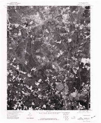
1974 Map of Chester
USGS Topo · Published 1977About this map
Chester sits as the central hub of this orthophotoquad, captured during a period of significant suburban development in the mid-1970s. The aerial imagery, provided by the U.S. Geological Survey and the Virginia Division of Mineral Resources, offers a precise visual record of the land use patterns south of Richmond. The landscape transitions from the dense residential and commercial street grids of the town center to more rural, wooded parcels and industrial clearings. To the east, the winding course of the James River defines the natural boundary of the quadrangle, where the tidal waters meet the coastal plain. The southern edge of the sheet reaches into the outskirts of Colonial Heights, showing the expanding infrastructure and transportation corridors that linked these growing Virginia communities during the late twentieth century.
Find a feature on this map
3 named features on this map. Tap any name to fly to it.
Don’t see what you’re looking for? This feature index may not catch every label — zoom into the map to look around manually.
Map Details
Editions of this 1974 Chester Map
This is the sole edition of this map. No revisions or reprints were ever made.
Other maps of this area

1894 · Bermuda Hundred
USGS Topo · 1:62,500

1894 · Petersburg
USGS Topo · 1:62,500

1897 · Amelia
USGS Topo · 1:125,000

1938 · Dutch Gap
USGS Topo · 1:24,000

1938 · Drewrys Bluff
USGS Topo · 1:24,000

1943 · Dutch Gap
USGS Topo · 1:31,680

1943 · Chesterfield
USGS Topo · 1:31,680

1943 · Hopewell
USGS Topo · 1:31,680

1943 · Beach
USGS Topo · 1:24,000

1943 · Sutherland
USGS Topo · 1:24,000