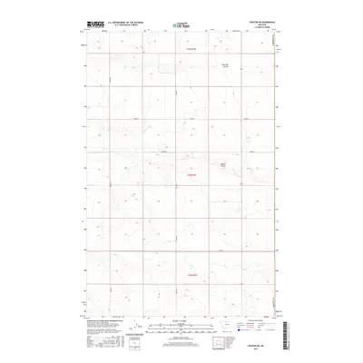
2017 Map of Chester NE
USGS Topo · Published 2017About this map
Fourmile Coulee and O'Brien Coulee incise the high plains of Hill County near the boundary of Liberty Co. This 2017 survey shows a landscape defined by the Public Land Survey System, with sections organized under townships T35N R7E, T34N R7E, and T33N R7E. The terrain is sparsely populated, dominated by a geometric grid of rural routes including Bison Rd, Haul Rd, and several numbered roads such as 2000 Rd S. The drainage patterns of the coulees contrast with the straight lines of the agricultural road network, illustrating how modern land management interacts with the natural topography of Northern Montana. This sheet is particularly useful for understanding contemporary land divisions and accessing remote sections of the northern prairie.
Find a feature on this map
13 named features on this map. Tap any name to fly to it.
Don’t see what you’re looking for? This feature index may not catch every label — zoom into the map to look around manually.
Map Details
Editions of this 2017 Chester NE Map
This is the sole edition of this map. No revisions or reprints were ever made.
Other maps of this area

1919 · Alma
USGS Topo · 1:125,000

1954 · Shelby
USGS Topo · 1:250,000

1958 · Shelby
USGS Topo · 1:250,000

1963 · Joplin
USGS Topo · 1:24,000

1963 · Bobcat Coulee SE
USGS Topo · 1:24,000

1963 · Vaver Reservoir
USGS Topo · 1:24,000

1963 · Chester NW
USGS Topo · 1:24,000

1963 · Chester NE
USGS Topo · 1:24,000

1963 · Chester
USGS Topo · 1:24,000

1972 · Goldstone SW
USGS Topo · 1:24,000