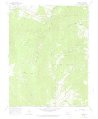
1967 Map of Chester
USGS Topo · Published 1969About this map
The Continental Divide winds through this high-altitude landscape in Saguache County, forming the boundary between the Gunnison National Forest and the Rio Grande National Forest. The map is characterized by a network of drainage basins, including Marshall Creek and Sevenmile Creek, which carve through the Cochetopa Hills. Near the northern border, the small settlement of Chester lies along an Old Railroad Grade, providing evidence of historical transportation routes that once navigated these mountain passes.
Find a feature on this map
28 named features on this map. Tap any name to fly to it.
Don’t see what you’re looking for? This feature index may not catch every label — zoom into the map to look around manually.
Map Details
Editions of this 1967 Chester Map
3 editions found
Other maps of this area

1956 · Montrose
USGS Topo · 1:250,000

1959 · Montrose
USGS Topo · 1:250,000

1959 · Bonanza
USGS Topo · 1:62,500

1960 · Montrose
USGS Topo · 1:250,000

1964 · Sargents
USGS Topo · 1:24,000

1967 · Sargents Mesa
USGS Topo · 1:24,000

1967 · Trickle Mountain
USGS Topo · 1:24,000

1967 · Lake Mountain NE
USGS Topo · 1:24,000

1967 · Chester
USGS Topo · 1:24,000

1967 · Pahlone Peak
USGS Topo · 1:24,000