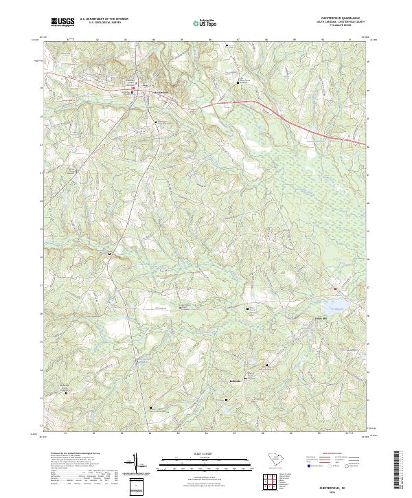
2024 Map of Chesterfield
USGS Topo · Published 2024About this map
Chesterfield serves as the focal point of this survey, where the Chesterfield County Courthouse stands at the center of a grid defined by W Main St and N Page St. The landscape is defined by an intricate network of waterways including Thompson Creek, Indian Creek, and Big Bear Creek, which historically powered local industry as evidenced by Robeson Millpond, Merriman Millpond, and Teal Millpond. Local heritage is deeply rooted in the rural community, with numerous long-standing congregations such as Oakland Church and Peniel Church dotting the countryside.
Find a feature on this map
148 named features on this map. Tap any name to fly to it.
Don’t see what you’re looking for? This feature index may not catch every label — zoom into the map to look around manually.
Map Details
Editions of this 2024 Chesterfield Map
This is the sole edition of this map. No revisions or reprints were ever made.
Other maps of this area

1941 · Spartanburg
USGS Topo · 1:250,000

1942 · Rockingham
USGS Topo · 1:125,000

1953 · Florence
USGS Topo · 1:250,000

1953 · Spartanburg
USGS Topo · 1:250,000

1954 · Florence
USGS Topo · 1:250,000

1960 · Spartanburg
USGS Topo · 1:250,000

1963 · Spartanburg
USGS Topo · 1:250,000

1964 · Spartanburg
USGS Topo · 1:250,000

1968 · Chesterfield
USGS Topo · 1:24,000

1968 · Patrick
USGS Topo · 1:24,000