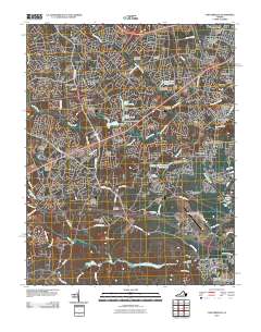
2010 Map of Chesterfield
USGS Topo · Published 2010About this map
The suburban development of Chesterfield County south of Richmond is characterized by a dense network of residential subdivisions and community landmarks. Neighborhoods like Wedgewood, Mayfair Estates, and Kings Forest are interspersed with historical family burial grounds including Providence Cemetery and Mount Giea Cemetery. The landscape is defined by the drainage of Falling Creek and Pocoshock Creek, which have been modified over time to create numerous impoundments such as Upper Beaver Pond and the Licking Creek Fishing Club Lake. Significant local infrastructure is evident at the Chesterfield County Airport and the Chesterfield Post Office, while the southern portion of the map is dominated by the expansive Swift Creek Lake and recreational sites like Camp Shawondasee. This 2010 survey illustrates the transition of the area into a sprawling residential corridor, where the legacy of older farms such as Jessup Farm Acres persists in the modern street names and tract boundaries.
Find a feature on this map
92 named features on this map. Tap any name to fly to it.
Don’t see what you’re looking for? This feature index may not catch every label — zoom into the map to look around manually.
Map Details
Editions of this 2010 Chesterfield Map
This is the sole edition of this map. No revisions or reprints were ever made.
Other maps of this area

1890 · Goochland
USGS Topo · 1:125,000

1892 · Goochland
USGS Topo · 1:125,000

1894 · Bermuda Hundred
USGS Topo · 1:62,500

1894 · Richmond
USGS Topo · 1:62,500

1895 · Richmond
USGS Topo · 1:62,500

1897 · Amelia
USGS Topo · 1:125,000

1934 · Richmond
USGS Topo · 1:24,000

1936 · Richmond West
USGS Topo · 1:24,000

1938 · Drewrys Bluff
USGS Topo · 1:24,000

1939 · Richmond
USGS Topo · 1:31,680