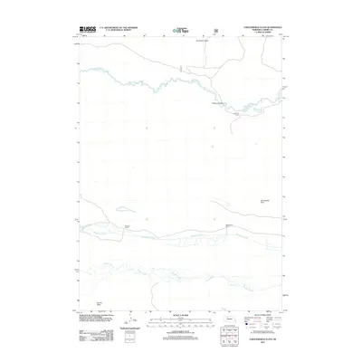
2011 Map of Chesterfield Flats
USGS Topo · Published 2011About this map
Snake River winds across this section of Cherry County, defining a landscape of riparian corridors and expansive plains. The terrain is marked by distinct topographical features such as Tombstone Valley in the north and Big Dry Valley to the south, while the central plateau is dominated by the Chesterfield Flats. This 2011 survey illustrates the continued importance of ranching and remote outposts in the Nebraska Sandhills, centering on named locations like Bachelor Ranch and Ravenscroft Ranch.
Find a feature on this map
10 named features on this map. Tap any name to fly to it.
Don’t see what you’re looking for? This feature index may not catch every label — zoom into the map to look around manually.
Map Details
Editions of this 2011 Chesterfield Flats Map
This is the sole edition of this map. No revisions or reprints were ever made.
Other maps of this area

1949 · Big Falls
USGS Topo · 1:62,500

1950 · Powderhorn Valley
USGS Topo · 1:62,500

1950 · Kennedy
USGS Topo · 1:62,500

1951 · Big Falls
USGS Topo · 1:62,500

1951 · Bull Lake
USGS Topo · 1:62,500

1957 · Valentine
USGS Topo · 1:250,000

1959 · Valentine
USGS Topo · 1:250,000

1985 · Powderhorn Valley SW
USGS Topo · 1:24,000

1985 · Mullen
USGS Topo · 1:100,000

1985 · Goose Creek
USGS Topo · 1:100,000