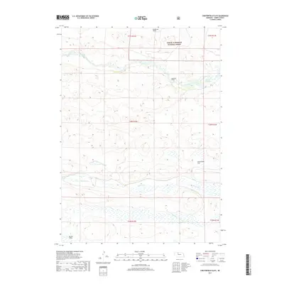
2017 Map of Chesterfield Flats
USGS Topo · Published 2017About this map
The Samuel R McKelvie National Forest occupies the northern reaches of this landscape, where the Snake River carves a winding path toward the Merritt Reservoir in the northeast. This portion of Cherry County is defined by its complex drainage systems and the broad, open stretches of the Chesterfield Flats. The map reveals a remote ranching or conservation environment where water is the primary landmark, including the southern flow of Boardman Cr and Gordon Cr.
Find a feature on this map
16 named features on this map. Tap any name to fly to it.
Don’t see what you’re looking for? This feature index may not catch every label — zoom into the map to look around manually.
Map Details
Editions of this 2017 Chesterfield Flats Map
This is the sole edition of this map. No revisions or reprints were ever made.
Other maps of this area

1949 · Big Falls
USGS Topo · 1:62,500

1950 · Powderhorn Valley
USGS Topo · 1:62,500

1950 · Kennedy
USGS Topo · 1:62,500

1951 · Big Falls
USGS Topo · 1:62,500

1951 · Bull Lake
USGS Topo · 1:62,500

1957 · Valentine
USGS Topo · 1:250,000

1959 · Valentine
USGS Topo · 1:250,000

1985 · Powderhorn Valley SW
USGS Topo · 1:24,000

1985 · Mullen
USGS Topo · 1:100,000

1985 · Goose Creek
USGS Topo · 1:100,000