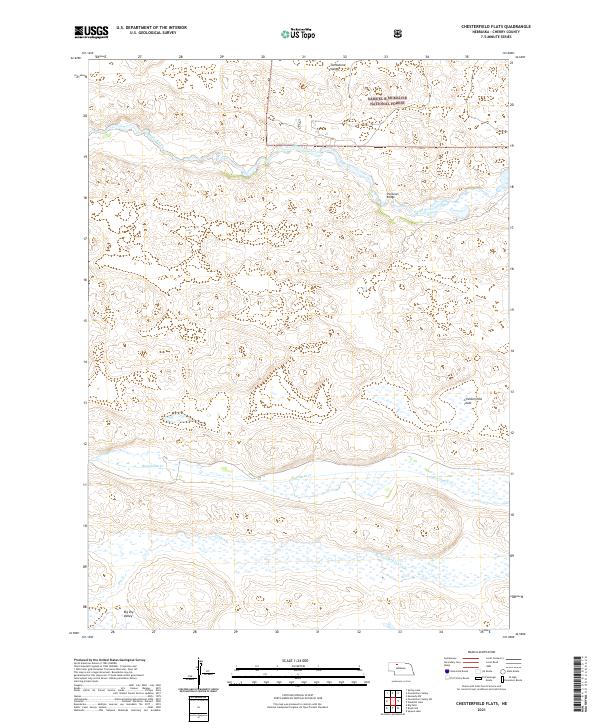
2021 Map of Chesterfield Flats
USGS Topo · Published 2021About this map
Samuel R McKelvie National Forest dominates the northern reaches of this Cherry County landscape, where the meandering Snake River cuts through the Nebraska sandhills. The area is defined by its dramatic drainage systems and valleys, including Tombstone Valley to the north and Big Dry Valley in the southwest. A sense of the region's isolated settlement pattern is found at Chesterfield Flats, while the presence of Shelbourn Bridge indicates a critical crossing point over the river's winding course. Parallel watercourses like Boardman Cr and Gordon Cr define the central and southern sections, illustrating the hydrologic character of the Great Plains. The map provides a contemporary look at these public lands and the intermittent streams, such as Dry Cr, that shape the local topography.
Find a feature on this map
15 named features on this map. Tap any name to fly to it.
Don’t see what you’re looking for? This feature index may not catch every label — zoom into the map to look around manually.
Map Details
Editions of this 2021 Chesterfield Flats Map
This is the sole edition of this map. No revisions or reprints were ever made.
Other maps of this area

1949 · Big Falls
USGS Topo · 1:62,500

1950 · Powderhorn Valley
USGS Topo · 1:62,500

1950 · Kennedy
USGS Topo · 1:62,500

1951 · Big Falls
USGS Topo · 1:62,500

1951 · Bull Lake
USGS Topo · 1:62,500

1957 · Valentine
USGS Topo · 1:250,000

1959 · Valentine
USGS Topo · 1:250,000

1985 · Powderhorn Valley SW
USGS Topo · 1:24,000

1985 · Mullen
USGS Topo · 1:100,000

1985 · Goose Creek
USGS Topo · 1:100,000