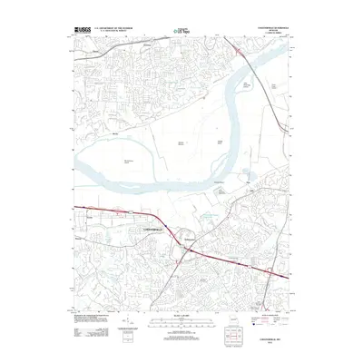
2012 Map of Chesterfield
USGS Topo · Published 2012About this map
The Missouri River carves a broad path through this 2012 landscape, separating the dense suburban developments of Chesterfield from the agricultural lowlands of Greens Bottom. This survey captures the region during a period of significant commercial expansion, notably around The Lamp and Lantern Village and the Town and Country Post Office. While modern infrastructure dominates, including the Maryland Heights Expy, historical anchors remain visible in the form of the Conway Cemetery and Everwine Cemetery. Industrial and utility footprints are established by the Saint Louis City Waterworks near Hine and the Creve Coeur Airport to the east. Several islands, such as Jane Downing Island and Bonhomme Island, highlight the shifting hydrologic character of the river valley as it transitions into the developed hillsides of Bellefontaine and Harvester.
Find a feature on this map
86 named features on this map. Tap any name to fly to it.
Don’t see what you’re looking for? This feature index may not catch every label — zoom into the map to look around manually.
Map Details
Editions of this 2012 Chesterfield Map
This is the sole edition of this map. No revisions or reprints were ever made.
Other maps of this area

1903 · O'Fallon
USGS Topo · 1:125,000

1924 · Robertson
USGS Topo · 1:24,000

1927 · St. Charles
USGS Topo · 1:62,500

1931 · Manchester SE
USGS Topo · 1:24,000

1931 · Brussels
USGS Topo · 1:62,500

1932 · Manchester NE
USGS Topo · 1:24,000

1933 · Creve Coeur
USGS Topo · 1:24,000

1933 · Saint Charles
USGS Topo · 1:62,500

1933 · Kirkwood
USGS Topo · 1:24,000

1937 · Weldon Spring
USGS Topo · 1:24,000