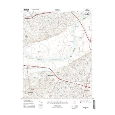
2015 Map of Chesterfield
USGS Topo · Published 2015About this map
The Missouri River carves a broad path through this 2015 landscape, defining the boundary between St. Charles and St. Louis counties. On the northern banks, suburban expansion around St. Peters and Harvester meets the alluvial plains of Greens Bottom, where Greens Chute and several river islands like Bonhomme Island and Catfish Island mark the shifting hydrology of the valley. To the south, the city of Chesterfield serves as a major hub of commerce and transit, anchored by the Chesterfield Airport Rd corridor and residential developments reaching toward Wildwood and Town and Country. The map records significant institutional presence, including Maryville Univ of Saint Louis and the Logan Coll of Chiropractic. Local history is preserved at sites like the Saint Johns United Church of Christ and its associated cemetery, alongside the Conway Cemetery further east.
Find a feature on this map
52 named features on this map. Tap any name to fly to it.
Don’t see what you’re looking for? This feature index may not catch every label — zoom into the map to look around manually.
Map Details
Editions of this 2015 Chesterfield Map
This is the sole edition of this map. No revisions or reprints were ever made.
Other maps of this area

1903 · O'Fallon
USGS Topo · 1:125,000

1924 · Robertson
USGS Topo · 1:24,000

1927 · St. Charles
USGS Topo · 1:62,500

1931 · Manchester SE
USGS Topo · 1:24,000

1931 · Brussels
USGS Topo · 1:62,500

1932 · Manchester NE
USGS Topo · 1:24,000

1933 · Creve Coeur
USGS Topo · 1:24,000

1933 · Saint Charles
USGS Topo · 1:62,500

1933 · Kirkwood
USGS Topo · 1:24,000

1937 · Weldon Spring
USGS Topo · 1:24,000