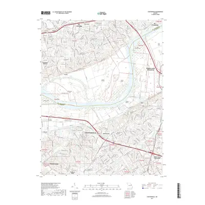
2017 Map of Chesterfield
USGS Topo · Published 2017About this map
The Missouri River carves a winding path across this landscape, separating the suburban growth of Chesterfield and Maryland Heights in St. Louis County from St. Peters and St. Charles to the north. This map captures a developed region where modern academic institutions like Logan Univ and Maryville Univ stand alongside long-established local landmarks. The floodplain south of the river, known as Greens Bottom, contains several significant islands including Bonhomme Island and Catfish Island, illustrating the river's historical shifting course. Cultural history is anchored by sites like the Sainte Philippine Cimetiere and the Saint Johns United Church of Christ Cem, providing specific points of interest for genealogists tracing family roots in this Missouri riverfront corridor.
Find a feature on this map
49 named features on this map. Tap any name to fly to it.
Don’t see what you’re looking for? This feature index may not catch every label — zoom into the map to look around manually.
Map Details
Editions of this 2017 Chesterfield Map
This is the sole edition of this map. No revisions or reprints were ever made.
Other maps of this area

1903 · O'Fallon
USGS Topo · 1:125,000

1924 · Robertson
USGS Topo · 1:24,000

1927 · St. Charles
USGS Topo · 1:62,500

1931 · Manchester SE
USGS Topo · 1:24,000

1931 · Brussels
USGS Topo · 1:62,500

1932 · Manchester NE
USGS Topo · 1:24,000

1933 · Creve Coeur
USGS Topo · 1:24,000

1933 · Saint Charles
USGS Topo · 1:62,500

1933 · Kirkwood
USGS Topo · 1:24,000

1937 · Weldon Spring
USGS Topo · 1:24,000