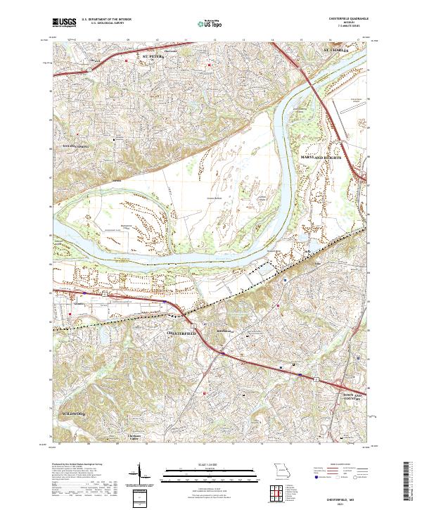
2021 Map of Chesterfield
USGS Topo · Published 2021About this map
Chesterfield and the neighboring suburban reaches of St. Louis Co and St. Charles Co are defined here by the wide valley of the Missouri River. The landscape transitions from the developed heights of Maryland Heights and Town And Country down into the expansive Greens Bottom, where the Katy Trail follows the northern bank. This riverine geography is punctuated by several large islands, including Jane Downing Island and Catfish Island, while the southern bank features the protected wetlands near Howard Bend. Local heritage is preserved in numerous family and church burial grounds, from the Stuart Family Cem in Clarkson Valley to the Sainte Philippine Cimetière near Weldon Spring. The map also highlights the area's educational and logistical hubs, featuring the campuses of Logan University and Maryville University alongside the Creve Coeur Airport.
Find a feature on this map
51 named features on this map. Tap any name to fly to it.
Don’t see what you’re looking for? This feature index may not catch every label — zoom into the map to look around manually.
Map Details
Editions of this 2021 Chesterfield Map
This is the sole edition of this map. No revisions or reprints were ever made.
Other maps of this area

1903 · O'Fallon
USGS Topo · 1:125,000

1924 · Robertson
USGS Topo · 1:24,000

1927 · St. Charles
USGS Topo · 1:62,500

1931 · Manchester SE
USGS Topo · 1:24,000

1931 · Brussels
USGS Topo · 1:62,500

1932 · Manchester NE
USGS Topo · 1:24,000

1933 · Creve Coeur
USGS Topo · 1:24,000

1933 · Saint Charles
USGS Topo · 1:62,500

1933 · Kirkwood
USGS Topo · 1:24,000

1937 · Weldon Spring
USGS Topo · 1:24,000