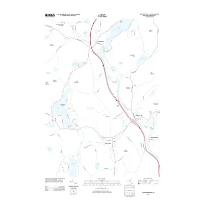
2013 Map of Chestertown
USGS Topo · Published 2013About this map
The hamlets of Chestertown and Pottersville anchor this 2013 survey of the southeastern Adirondacks, where the Schroon River and Interstate 87 carve a north-south corridor through the mountains. This modern topography documents a landscape defined by its glacial heritage, featuring a concentration of recreationally significant water bodies including Schroon Lake, Friends Lake, Loon Lake, and the western edge of Brant Lake. Much of the area falls within the Adirondack Park Preserve, protecting landmarks like the Adirondack Natural Stone Bridge on Trout Brook. Smaller settlements such as Starbuckville and South Horicon are shown along the river, illustrating the persistent importance of valley routes. The map provides a detailed view of the local road network, from established routes like Olmstedville Rd to specialized tracks like Camp-A-Lot Rd, reflecting the area's dual identity as both a year-round community and a seasonal mountain destination.
Find a feature on this map
95 named features on this map. Tap any name to fly to it.
Don’t see what you’re looking for? This feature index may not catch every label — zoom into the map to look around manually.
Map Details
Editions of this 2013 Chestertown Map
This is the sole edition of this map. No revisions or reprints were ever made.
Other maps of this area

1895 · North Creek
USGS Topo · 1:62,500

1895 · Paradox Lake
USGS Topo · 1:62,500

1897 · Bolton
USGS Topo · 1:62,500

1897 · Paradox Lake
USGS Topo · 1:62,500

1897 · North Creek
USGS Topo · 1:62,500

1897 · Schroon Lake
USGS Topo · 1:62,500

1900 · Bolton
USGS Topo · 1:62,500

1950 · Glens Falls
USGS Topo · 1:250,000
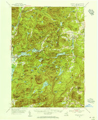
1953 · Paradox Lake
USGS Topo · 1:62,500

1953 · Schroon Lake
USGS Topo · 1:62,500