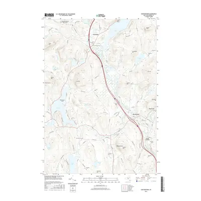
2016 Map of Chestertown
USGS Topo · Published 2016About this map
Chestertown and Pottersville anchor this map of the southeastern Adirondack region, where the Schroon River flows southward toward its eventual confluence with the Hudson. The landscape is defined by a dense network of water bodies, including the northern reach of Schroon Lake, the sprawling Loon Lake with its Blythewood Island, and Friends Lake. For those interested in the geological curiosities of the area, the Adirondack Natural Stone Bridge is situated in the northwest corner along Trout Brook. The map reveals a settled corridor following the river valley, with smaller hamlets like Starbuckville and South Horicon connected by local routes such as Valley Farm Rd and Co RD 64. The area is hemmed in by numerous peaks, including Panther Mtn, Kipp Mtn, and Eagle Point, illustrating the localized development constrained by the region's steep elevations.
Find a feature on this map
110 named features on this map. Tap any name to fly to it.
Don’t see what you’re looking for? This feature index may not catch every label — zoom into the map to look around manually.
Map Details
Editions of this 2016 Chestertown Map
This is the sole edition of this map. No revisions or reprints were ever made.
Other maps of this area

1895 · North Creek
USGS Topo · 1:62,500

1895 · Paradox Lake
USGS Topo · 1:62,500

1897 · Bolton
USGS Topo · 1:62,500

1897 · Paradox Lake
USGS Topo · 1:62,500

1897 · North Creek
USGS Topo · 1:62,500

1897 · Schroon Lake
USGS Topo · 1:62,500

1900 · Bolton
USGS Topo · 1:62,500

1950 · Glens Falls
USGS Topo · 1:250,000
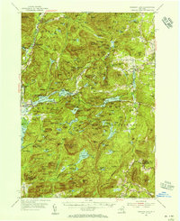
1953 · Paradox Lake
USGS Topo · 1:62,500

1953 · Schroon Lake
USGS Topo · 1:62,500