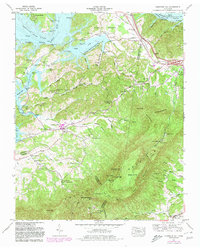
1961 Map of Chestnut Hill
USGS Topo · Published 1980About this map
Chestnut Hill sits at the nexus of the French Broad River valley and the northern slopes of English Mountain in this 1961 Tennessee survey, revised in 1980. The landscape is defined by the expansive waters of Douglas Lake and the French Broad River, which serve as the northern boundary for a series of tight hollows and ridges. This map reveals a community-centered landscape, with numerous landmarks such as Blowing Cave Mill and Blowing Cave School near the geological feature of Blowing Cave.
Find a feature on this map
82 named features on this map. Tap any name to fly to it.
Don’t see what you’re looking for? This feature index may not catch every label — zoom into the map to look around manually.
Map Details
Editions of this 1961 Chestnut Hill Map
3 editions found
Other maps of this area

1883 · Morristown
USGS Topo · 1:125,000

1893 · Mt Guyot
USGS Topo · 1:125,000

1893 · Morristown
USGS Topo · 1:125,000

1895 · Morristown
USGS Topo · 1:125,000

1912 · Mt Guyot
USGS Topo · 1:125,000

1935 · Newport
USGS Topo · 1:48,000

1935 · White Pine
USGS Topo · 1:24,000

1935 · Hartford
USGS Topo · 1:24,000

1935 · English Mountain
USGS Topo · 1:48,000

1935 · Clevenger
USGS Topo · 1:24,000