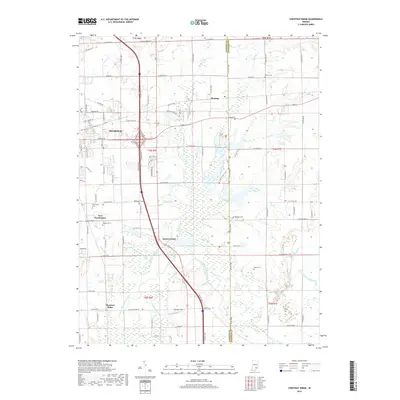
2019 Map of Chestnut Ridge
USGS Topo · Published 2019About this map
The southeastern sprawl of Seymour and the wetlands bordering the Vernon Fork Muscatatuck River define this portion of Jackson County. This landscape is a complex network of agricultural drainage and natural waterways, featuring extensive engineered segments like Mutton Creek Ditch and the John McDonald Ditch that run alongside historical settlements. Smaller communities and crossroads like New Farmington, Fleming, and Kriete Corner are interspersed among family burial grounds such as Barkman Cem and Driftwood Cem. The southern reach of the map is dominated by the marshy lowland of the river, while the namesake Chestnut Ridge sits at the western edge, overlooking the valley. Aviation and infrastructure are also evident with the presence of Stewart Field nestled between the various creek branches that feed into the larger Muscatatuck basin.
Find a feature on this map
108 named features on this map. Tap any name to fly to it.
Don’t see what you’re looking for? This feature index may not catch every label — zoom into the map to look around manually.
Map Details
Editions of this 2019 Chestnut Ridge Map
This is the sole edition of this map. No revisions or reprints were ever made.
Other maps of this area

1942 · Columbus
USGS Topo · 1:125,000

1953 · Cincinnati
USGS Topo · 1:250,000

1956 · Deputy
USGS Topo · 1:24,000

1956 · Louisville
USGS Topo · 1:250,000

1957 · Cincinnati
USGS Topo · 1:250,000

1957 · Jonesville
USGS Topo · 1:24,000

1957 · Azalia
USGS Topo · 1:24,000

1957 · North Vernon
USGS Topo · 1:24,000

1958 · Seymour
USGS Topo · 1:24,000

1959 · Tampico
USGS Topo · 1:24,000