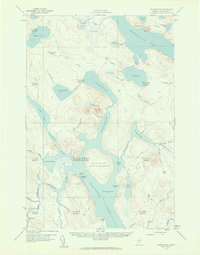
1958 Map of Chesuncook
USGS Topo · Published 1961About this map
Chesuncook Village and Chamberlain Farm anchor this 1950s study of the Maine North Woods, a landscape dominated by the expansive Chamberlain Lake and its interconnected waterways. The map details a transition in the wilderness, where a telephone line and various trails and a Jeep Trail intersect the traditional carry routes such as the Carry Trail near Mud Pond. Historical points of interest include Graveyard Point on the shores of Chesuncook Lake, while large-scale conservation efforts are evident in the State Game Refuge on Gero Island. The intricate network of brooks and bogs, including Ellis Bog and Carry Bog, reflects the complex drainage patterns vital to the regional logging and trapping history that defined these townships.
Find a feature on this map
72 named features on this map. Tap any name to fly to it.
Don’t see what you’re looking for? This feature index may not catch every label — zoom into the map to look around manually.
Map Details
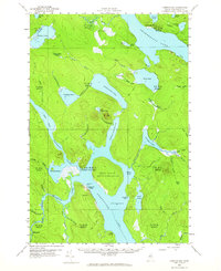
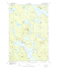
Editions of this 1958 Chesuncook Map
4 editions found

Other maps of this area

1953 · Telos Lake
USGS Topo · 1:62,500

1954 · Chesuncook
USGS Topo · 1:62,500

1954 · North East Carry
USGS Topo · 1:62,500

1954 · Spider Lake
USGS Topo · 1:62,500

1954 · Caucomgomoc Lake
USGS Topo · 1:62,500

1954 · Churchill Lake
USGS Topo · 1:62,500

1954 · Allagash Lake
USGS Topo · 1:62,500

1954 · Grant Farm
USGS Topo · 1:62,500

1954 · Harrington Lake
USGS Topo · 1:62,500

1954 · Presque Isle
USGS Topo · 1:250,000