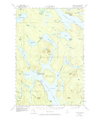
1958 Map of Chesuncook
USGS Topo · Published 1972About this map
Chesuncook village sits at the confluence of the Penobscot River West Branch and the vast waters of Chesuncook Lake, a landscape defined by timber history and the remote township divisions of the North Maine Woods. The map details the transition from the river systems to the northern reach of Chamberlain Lake, featuring the historic Chamberlain Farm and its associated settlement.
Find a feature on this map
70 named features on this map. Tap any name to fly to it.
Don’t see what you’re looking for? This feature index may not catch every label — zoom into the map to look around manually.
Map Details
Editions of this 1958 Chesuncook Map
4 editions found

Other maps of this area

1953 · Telos Lake
USGS Topo · 1:62,500

1954 · Chesuncook
USGS Topo · 1:62,500

1954 · North East Carry
USGS Topo · 1:62,500

1954 · Spider Lake
USGS Topo · 1:62,500

1954 · Caucomgomoc Lake
USGS Topo · 1:62,500

1954 · Churchill Lake
USGS Topo · 1:62,500

1954 · Allagash Lake
USGS Topo · 1:62,500

1954 · Grant Farm
USGS Topo · 1:62,500

1954 · Harrington Lake
USGS Topo · 1:62,500

1954 · Presque Isle
USGS Topo · 1:250,000