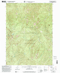
1998 Map of Chetco Peak
USGS Topo · Published 2001About this map
The Siskiyou National Forest and the Kalmiopsis Wilderness dominate this high-elevation terrain, where the headwaters of the Chetco River and the North Fork Smith River carve through the mountains. This late-twentieth-century landscape is defined by its industrial and residential remnants, including the Gardner Mine and several unnamed Mine and Prospect workings near Moores Ridge. The map identifies historical occupation sites such as Madstone Cabin, Fresno Camp, and Brokenkot Camp, offering evidence of the area's history of backcountry habitation and resource extraction. Prominent summits like Chetco Peak, Vulcan Peak, and Bailey Mountain provide a dramatic backdrop to high mountain waters including Vulcan Lake, Chetco Lake, and Salamander Lake. The isolation of the region is underscored by the lack of developed roads, with movement dictated by the natural corridors of Box Canyon and the surrounding ridgelines.
Find a feature on this map
40 named features on this map. Tap any name to fly to it.
Don’t see what you’re looking for? This feature index may not catch every label — zoom into the map to look around manually.
Map Details
Editions of this 1998 Chetco Peak Map
This is the sole edition of this map. No revisions or reprints were ever made.
Other maps of this area

1917 · Kerby
USGS Topo · 1:125,000

1918 · Kerby
USGS Topo · 1:125,000

1945 · Kerby
USGS Topo · 1:125,000

1954 · Coos Bay
USGS Topo · 1:250,000

1954 · Chetco Peak
USGS Topo · 1:62,500

1954 · Collier Butte
USGS Topo · 1:62,500

1954 · Mt. Emily
USGS Topo · 1:62,500

1954 · Pearsoll Peak
USGS Topo · 1:62,500

1955 · Medford
USGS Topo · 1:250,000

1957 · Medford
USGS Topo · 1:250,000