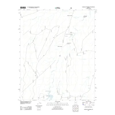
2011 Map of Chevelon Crossing
USGS Topo · Published 2011About this map
Chevelon Creek carves a deep path through this Coconino County landscape, creating a network of steep-walled drainages and vital water access points. Historically significant fords like Chevelon Crossing, Mormon Crossing, and Durfee Crossing mark where early travel routes negotiated the canyon system. The 2011 survey highlights a high concentration of water management features, including several "trick tanks" such as Turkey Trick Tank and Pueblo Trick Tank, which are specialized catchments designed to collect precipitation for local wildlife or livestock in this arid environment.
Find a feature on this map
56 named features on this map. Tap any name to fly to it.
Don’t see what you’re looking for? This feature index may not catch every label — zoom into the map to look around manually.
Map Details
Editions of this 2011 Chevelon Crossing Map
This is the sole edition of this map. No revisions or reprints were ever made.
Other maps of this area

1886 · Holbrook
USGS Topo · 1:250,000

1893 · Holbrook
USGS Topo · 1:250,000

1954 · Holbrook
USGS Topo · 1:250,000

1957 · Holbrook
USGS Topo · 1:250,000

1958 · Holbrook
USGS Topo · 1:250,000

1960 · Holbrook
USGS Topo · 1:250,000

1961 · Woods Canyon
USGS Topo · 1:62,500

1961 · Heber
USGS Topo · 1:62,500
1965 · Grama Draw
USGS Topo · 1:24,000

1965 · Chevelon Crossing
USGS Topo · 1:24,000