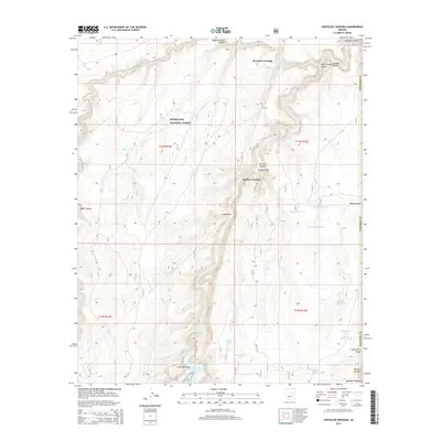
2014 Map of Chevelon Crossing
USGS Topo · Published 2014About this map
Mormon Crossing and Durfee Crossing serve as historic focal points along the deep drainage of Chevelon Cr as it carves through the high country. Located within the Sitgreaves National Forest, this portion of the Mogollon Plateau is defined by a complex network of canyons and draws, including West Chevelon Canyon, Elk Rub Canyon, and Wildcat Canyon.
Find a feature on this map
37 named features on this map. Tap any name to fly to it.
Don’t see what you’re looking for? This feature index may not catch every label — zoom into the map to look around manually.
Map Details
Editions of this 2014 Chevelon Crossing Map
This is the sole edition of this map. No revisions or reprints were ever made.
Other maps of this area

1886 · Holbrook
USGS Topo · 1:250,000

1893 · Holbrook
USGS Topo · 1:250,000

1954 · Holbrook
USGS Topo · 1:250,000

1957 · Holbrook
USGS Topo · 1:250,000

1958 · Holbrook
USGS Topo · 1:250,000

1960 · Holbrook
USGS Topo · 1:250,000

1961 · Woods Canyon
USGS Topo · 1:62,500

1961 · Heber
USGS Topo · 1:62,500
1965 · Grama Draw
USGS Topo · 1:24,000

1965 · Chevelon Crossing
USGS Topo · 1:24,000