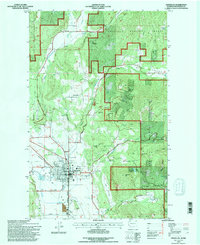
1992 Map of Chewelah
USGS Topo · Published 1996About this map
The mountain slopes of Colville National Forest dominate the landscape surrounding the established town of Chewelah in this early 1990s revision. The area's industrial legacy is etched into the terrain of Eagle Mtn and Quartzite Mtn, where a dense concentration of mining operations including the United Copper No 1 Mine, Copper King No 1 Mine, and Security Copper Mine are located. These sites, along with several Quarries, speak to the region's rich mineral history between the high ridges of Jay Ridge and the Lost Valley.
Find a feature on this map
67 named features on this map. Tap any name to fly to it.
Don’t see what you’re looking for? This feature index may not catch every label — zoom into the map to look around manually.
Map Details
Editions of this 1992 Chewelah Map
This is the sole edition of this map. No revisions or reprints were ever made.
Other maps of this area

1927 · Chewelah
USGS Topo · 1:125,000

1930 · Chewelah
USGS Topo · 1:125,000

1958 · Sandpoint
USGS Topo · 1:250,000

1963 · Sandpoint
USGS Topo · 1:250,000

1964 · Chewelah
USGS Topo · 1:24,000

1964 · Cliff Ridge
USGS Topo · 1:24,000
1964 · Calispell Peak
USGS Topo · 1:24,000

1964 · Goddards Peak
USGS Topo · 1:24,000

1964 · Chewelah Mtn
USGS Topo · 1:62,500

1965 · Waitts Lake
USGS Topo · 1:24,000