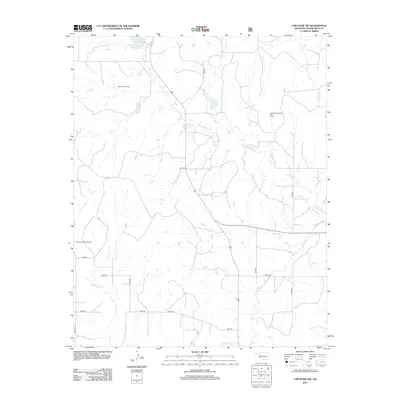
2012 Map of Cheyenne NW
USGS Topo · Published 2012About this map
Roll SW Gas Field and the Strong City District Gas Field dominate the northern and eastern portions of this Roger Mills County landscape, illustrating the critical role of energy extraction in western Oklahoma's 21st-century economy. The terrain is defined by the winding course of the Washita River in the south, which is fed by drainage systems including Dead Warrior Cr and Wild Horse Cr. Centrally, Dead Warrior Lake provides a localized water feature amidst a network of rural section roads like d1855 RD and e0910 RD. To the southwest, the Cheyenne West Gas Field further underscores the industrial footprint on the land, where traditional agricultural divisions meet the infrastructure of modern gas production.
Find a feature on this map
17 named features on this map. Tap any name to fly to it.
Don’t see what you’re looking for? This feature index may not catch every label — zoom into the map to look around manually.
Map Details
Editions of this 2012 Cheyenne NW Map
This is the sole edition of this map. No revisions or reprints were ever made.
Other maps of this area

1955 · Clinton
USGS Topo · 1:250,000

1957 · Clinton
USGS Topo · 1:250,000

1960 · Cheyenne
USGS Topo · 1:62,500

1961 · Reydon
USGS Topo · 1:62,500

1965 · Crawford
USGS Topo · 1:24,000

1966 · Roll
USGS Topo · 1:24,000

1966 · Roll SE
USGS Topo · 1:24,000

1984 · Foss Reservoir
USGS Topo · 1:100,000

1988 · Dempsey
USGS Topo · 1:24,000
1989 · Cheyenne NW
USGS Topo · 1:24,000