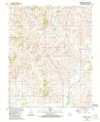
1989 Map of Cheyenne NW
USGS Topo · Published 1989About this map
Black Kettle National Grassland dominates this landscape in Roger Mills County, Oklahoma, where the prairie is defined by its watercourses and a growing energy infrastructure. The Washita River winds through the southern portion of the quadrangle, joined by tributaries such as Dead Indian Creek and Wild Horse Creek. This 1980s-era revision highlights the expansion of the natural gas industry, with numerous Gas Wells and a Pipeline network crisscrossing the terrain. Evidence of former transit routes remains visible in the Old Railroad Grade that follows the river valley. In the north, Dead Indian Lake serves as a recreational hub with a Campground, Picnic Area, and Boat Ramp documented by the survey. The terrain labels Streeter and Cheyenne mark the character of this Western Oklahoma landscape during a period of active land management and resource extraction.
Find a feature on this map
14 named features on this map. Tap any name to fly to it.
Don’t see what you’re looking for? This feature index may not catch every label — zoom into the map to look around manually.
Map Details
Editions of this 1989 Cheyenne NW Map
This is the sole edition of this map. No revisions or reprints were ever made.
Other maps of this area

1955 · Clinton
USGS Topo · 1:250,000

1957 · Clinton
USGS Topo · 1:250,000

1960 · Cheyenne
USGS Topo · 1:62,500

1961 · Reydon
USGS Topo · 1:62,500

1965 · Crawford
USGS Topo · 1:24,000

1966 · Roll
USGS Topo · 1:24,000

1966 · Roll SE
USGS Topo · 1:24,000

1984 · Foss Reservoir
USGS Topo · 1:100,000

1988 · Dempsey
USGS Topo · 1:24,000
1989 · Mackie
USGS Topo · 1:24,000