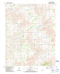
1989 Map of Mackie
USGS Topo · Published 1989About this map
Black Kettle National Grassland dominates the central landscape of this western Oklahoma survey, where the rolling plains meet the drainage of the Washita River. The terrain is marked by the winding courses of Rush Creek and Croton Creek, illustrating a landscape shaped by intermittent water and the remnants of early 20th-century infrastructure. A prominent Old Railroad Grade cuts through the territory near Mackie, tracing a former transport artery that once served this cattle-and-crops region.
Find a feature on this map
17 named features on this map. Tap any name to fly to it.
Don’t see what you’re looking for? This feature index may not catch every label — zoom into the map to look around manually.
Map Details
Editions of this 1989 Mackie Map
This is the sole edition of this map. No revisions or reprints were ever made.
Other maps of this area

1955 · Clinton
USGS Topo · 1:250,000

1957 · Clinton
USGS Topo · 1:250,000

1960 · Cheyenne
USGS Topo · 1:62,500

1961 · Reydon
USGS Topo · 1:62,500

1965 · Crawford
USGS Topo · 1:24,000

1966 · Roll
USGS Topo · 1:24,000

1966 · Durham
USGS Topo · 1:24,000

1984 · Foss Reservoir
USGS Topo · 1:100,000

1988 · Dempsey
USGS Topo · 1:24,000
1989 · Cheyenne NW
USGS Topo · 1:24,000