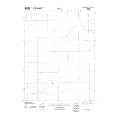
2010 Map of Cheyenne Wells NE
USGS Topo · Published 2010About this map
Old Wells sits near the southern edge of this High Plains landscape, situated along a section of the Smoky Hill River that cuts through the Cheyenne County terrain. The survey reflects a region defined by its agricultural grid and subterranean resources, specifically the Cheyenne Oil Field which occupies the southwestern corner of the quadrangle. Drainage patterns are dominated by the winding paths of the river and Big Timber Creek, which meanders through the northern and eastern sections. The road network follows a strict rectilinear pattern, with long-distance corridors like County Road Z and County Road V connecting the isolated ranchlands. This 2010 snapshot illustrates the persistent intersection of energy extraction and cattle country in eastern Colorado.
Find a feature on this map
19 named features on this map. Tap any name to fly to it.
Don’t see what you’re looking for? This feature index may not catch every label — zoom into the map to look around manually.
Map Details
Editions of this 2010 Cheyenne Wells NE Map
This is the sole edition of this map. No revisions or reprints were ever made.
Other maps of this area

1892 · Cheyenne Wells
USGS Topo · 1:125,000

1894 · Cheyenne Wells
USGS Topo · 1:125,000

1954 · Limon
USGS Topo · 1:250,000

1954 · Lamar
USGS Topo · 1:250,000

1957 · Limon
USGS Topo · 1:250,000

1958 · Limon
USGS Topo · 1:250,000

1958 · Lamar
USGS Topo · 1:250,000

1969 · Mount Sunflower SW
USGS Topo · 1:24,000

1969 · Burlington 3 SE
USGS Topo · 1:24,000
1969 · Burlington 3 SW
USGS Topo · 1:24,000