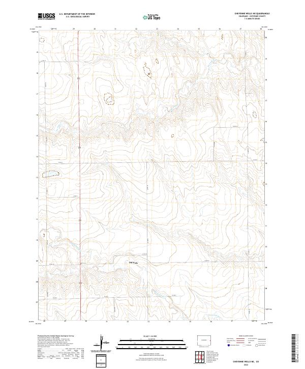
2022 Map of Cheyenne Wells NE
USGS Topo · Published 2022About this map
The Smoky Hill River meanders through the southern reaches of this Cheyenne County landscape, reflecting the essential role of water in this high-plains environment. Historically significant for its connection to early migration routes, the river corridor is joined by the settlement of Old Wells, located along Co Rd W. This location points to the vital importance of reliable water sources for early cattle ranching and homesteading in eastern Colorado. The terrain is further defined by the drainage of Big Timber Cr in the north, while a network of rural routes, such as Co Rd Z and Co Rd 46, provides a glimpse into the modern land management and township-and-range surveying that continues to structure the region today.
Find a feature on this map
18 named features on this map. Tap any name to fly to it.
Don’t see what you’re looking for? This feature index may not catch every label — zoom into the map to look around manually.
Map Details
Editions of this 2022 Cheyenne Wells NE Map
This is the sole edition of this map. No revisions or reprints were ever made.
Other maps of this area

1892 · Cheyenne Wells
USGS Topo · 1:125,000

1894 · Cheyenne Wells
USGS Topo · 1:125,000

1954 · Limon
USGS Topo · 1:250,000

1954 · Lamar
USGS Topo · 1:250,000

1957 · Limon
USGS Topo · 1:250,000

1958 · Limon
USGS Topo · 1:250,000

1958 · Lamar
USGS Topo · 1:250,000

1969 · Mount Sunflower SW
USGS Topo · 1:24,000

1969 · Burlington 3 SE
USGS Topo · 1:24,000
1969 · Burlington 3 SW
USGS Topo · 1:24,000