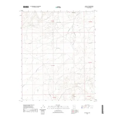
2020 Map of Chi Chil Tah
USGS Topo · Published 2020About this map
Chi Chil Tah is a focal point of this high-desert landscape within the Eastern Navajo Agency, where the terrain is defined by deep drainage systems and prominent landmarks like the Zuni Buttes. The movement of water across this arid plateau has carved significant features such as Whitewater Arroyo in the north and Bosson Wash to the south. Transportation in this region relies on a network of Bureau of Indian Affairs and local routes, including Indian Svc Rte 7010 and Stinkwater Well Rd. The map illustrates a complex system of canyon roads and mesa tracks, such as Oak Mesa Rd and White Water Canyon Rd, which reflect the historic and modern patterns of land use and navigation across these sprawling tribal lands in McKinley County.
Find a feature on this map
19 named features on this map. Tap any name to fly to it.
Don’t see what you’re looking for? This feature index may not catch every label — zoom into the map to look around manually.
Map Details
Editions of this 2020 Chi Chil Tah Map
This is the sole edition of this map. No revisions or reprints were ever made.
Other maps of this area

1886 · Wingate
USGS Topo · 1:250,000

1886 · Fort Defiance
USGS Topo · 1:250,000

1892 · Fort Defiance
USGS Topo · 1:250,000

1892 · Wingate
USGS Topo · 1:250,000

1954 · Gallup
USGS Topo · 1:250,000

1958 · Gallup
USGS Topo · 1:250,000

1959 · Gallup
USGS Topo · 1:250,000

1962 · Gallup
USGS Topo · 1:250,000

1963 · Jones Ranch School
USGS Topo · 1:24,000
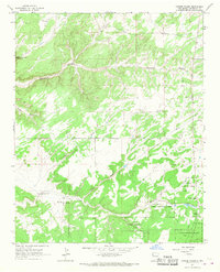
1963 · Vander Wagen
USGS Topo · 1:24,000
Featured Places
- Eastern Navajo Agency, NM
- Chi Chil Tah, Eastern Navajo Agency
- McKinley County, NM
- United States
- New Mexico