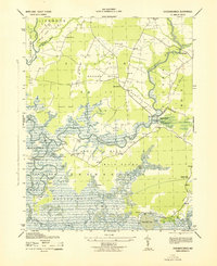
1943 Map of Chicamacomico
USGS Topo · Published 1943About this map
Chicamacomico River and Transquaking River define the intricate hydrology of this Dorchester County landscape, where the tides met the timber and farmland of the mid-20th century. The land is characterized by numerous necks—distinct peninsulas of high ground surrounded by marsh and water—including Tripps Neck, Griffith Neck, and Steels Neck. These landforms dictated the early patterns of settlement and transport, evidenced by the presence of Bestpitch Ferry and several landings such as Brick House Ldg and Cedar Ldg.
Find a feature on this map
49 named features on this map. Tap any name to fly to it.
Don’t see what you’re looking for? This feature index may not catch every label — zoom into the map to look around manually.
Map Details
Editions of this 1943 Chicamacomico Map
This is the sole edition of this map. No revisions or reprints were ever made.
Other maps of this area

1898 · Choptank
USGS Topo · 1:125,000

1898 · St. Marys
USGS Topo · 1:125,000

1903 · Nanticoke
USGS Topo · 1:62,500

1904 · Oxford
USGS Topo · 1:62,500

1905 · Crapo
USGS Topo · 1:62,500

1905 · Hurlock
USGS Topo · 1:62,500

1906 · St. Marys
USGS Topo · 1:125,000

1908 · Choptank
USGS Topo · 1:125,000

1942 · Wetipquin
USGS Topo · 1:24,000
1942 · Wingate
USGS Topo · 1:24,000