
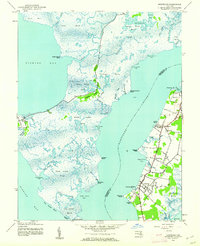
1942 Map of Wetipquin
USGS Topo · Published 1962About this map
Wetipquin Neck defines this coastal landscape where the Nanticoke River and Wicomico River nearly converge. Published in the early 1960s from data captured during the war years, this survey details a waterfront economy and social structure centered on small landings and rural parishes. The village of Whitehaven sits prominently on the Wicomico, serving as a hub near Ferry Point and the Widgeon Wharf. Inland, the map reveals a network of tight-knit communities such as New Town, Capitola, and Clara, connected by roads leading to essential landmarks like St Marys Ch.
Find a feature on this map
63 named features on this map. Tap any name to fly to it.
Don’t see what you’re looking for? This feature index may not catch every label — zoom into the map to look around manually.
Map Details
Editions of this 1942 Wetipquin Map
This is the sole edition of this map. No revisions or reprints were ever made.
Other maps of this area

1901 · Salisbury
USGS Topo · 1:62,500

1903 · Nanticoke
USGS Topo · 1:62,500

1903 · Deal Island
USGS Topo · 1:62,500

1942 · Deal Island
USGS Topo · 1:24,000

1942 · Monie
USGS Topo · 1:24,000

1942 · Princess Anne
USGS Topo · 1:24,000

1942 · Mardela Springs
USGS Topo · 1:24,000

1942 · Eden
USGS Topo · 1:24,000

1942 · Hebron
USGS Topo · 1:24,000
1942 · Nanticoke
USGS Topo · 1:24,000