
1942 Map of Eden
USGS Topo · Published 1962About this map
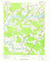
The Wicomico River serves as the primary artery for this Maryland coastal landscape, defining the boundary where Wicomico and Somerset Counties meet. At the time of this 1942 survey, the river economy is prominently displayed through a network of small landings and wharves, such as Quantico Wharf, Patricks Landing, and Keroo Wharf. Inland, the settlement of Allen sits near the head of Passerdyke Creek, while the Pennsylvania railroad line cuts through the eastern portion of the map, passing the village of Eden. This period reflects a transition in Chesapeake Bay area transportation, where the maritime tradition of river travel via Upper Ferry and Simms Wharf coexists with emerging road and rail networks. Notable landmarks like the Pine Bluff Sanitarium near Shad Point and the Lookout Tower near the head of Quantico Creek provide specific points of interest for local history researchers.
Find a feature on this map
51 named features on this map. Tap any name to fly to it.
Don’t see what you’re looking for? This feature index may not catch every label — zoom into the map to look around manually.
Map Details
Editions of this 1942 Eden Map
2 editions found
Other maps of this area

1901 · Salisbury
USGS Topo · 1:62,500

1903 · Nanticoke
USGS Topo · 1:62,500

1903 · Deal Island
USGS Topo · 1:62,500

1942 · Monie
USGS Topo · 1:24,000

1942 · Wetipquin
USGS Topo · 1:24,000

1942 · Princess Anne
USGS Topo · 1:24,000

1942 · Mardela Springs
USGS Topo · 1:24,000

1942 · Hebron
USGS Topo · 1:24,000

1942 · Dividing Creek
USGS Topo · 1:24,000

1942 · Salisbury
USGS Topo · 1:24,000