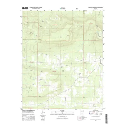
2017 Map of Chickalah Mountain East
USGS Topo · Published 2017About this map
The rugged terrain of the Ozark National Forest dominates this section of Yell County, where elevations rise toward the heights of Mt Nebo and Chickalah Mtn. The landscape is a complex of ridges and hollows, including North Bluff, South Bluff, and Haags Hollow, which dictate the winding paths of rural roads like Harkey Valley Rd. This geography has historically isolated the small communities of Chickalah, Sulphur Springs, and Ranger, preserving a network of family-linked landmarks and cemeteries.
Find a feature on this map
87 named features on this map. Tap any name to fly to it.
Don’t see what you’re looking for? This feature index may not catch every label — zoom into the map to look around manually.
Map Details
Editions of this 2017 Chickalah Mountain East Map
This is the sole edition of this map. No revisions or reprints were ever made.
Other maps of this area

1888 · Dardanelle #4
USGS Topo · 1:62,500

1888 · Dardanelle #2
USGS Topo · 1:62,500

1888 · Dardanelle #1
USGS Topo · 1:62,500

1888 · Dardanelle #3
USGS Topo · 1:62,500

1890 · Dardanelle
USGS Topo · 1:125,000

1956 · Russellville
USGS Topo · 1:250,000
1962 · New Blaine
USGS Topo · 1:24,000

1962 · Delaware
USGS Topo · 1:24,000
1963 · Russellville West
USGS Topo · 1:24,000

1964 · Russellville
USGS Topo · 1:250,000