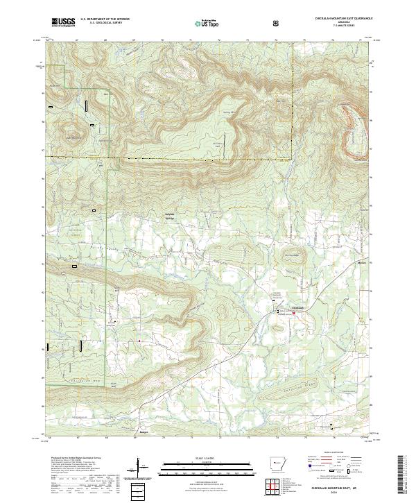
2024 Map of Chickalah Mountain East
USGS Topo · Published 2024About this map
Chickalah Mtn and the surrounding valley floor define this portion of Yell and Logan Counties. The terrain is marked by sharp topographic contrasts, from the high, flat-topped Mt Nebo and Sunrise Point in the northeast to the broad Harkey Valley below. This landscape has long supported dispersed rural communities, with the settlement of Chickalah serving as a central point for local residents. The distribution of small family and community burial grounds, such as Fulton Cem and the Chickalah Methodist Church Cem, reflects the deep-rooted settlement patterns of the area.
Find a feature on this map
91 named features on this map. Tap any name to fly to it.
Don’t see what you’re looking for? This feature index may not catch every label — zoom into the map to look around manually.
Map Details
Editions of this 2024 Chickalah Mountain East Map
This is the sole edition of this map. No revisions or reprints were ever made.
Other maps of this area

1888 · Dardanelle #4
USGS Topo · 1:62,500

1888 · Dardanelle #2
USGS Topo · 1:62,500

1888 · Dardanelle #1
USGS Topo · 1:62,500

1888 · Dardanelle #3
USGS Topo · 1:62,500

1890 · Dardanelle
USGS Topo · 1:125,000

1956 · Russellville
USGS Topo · 1:250,000
1962 · New Blaine
USGS Topo · 1:24,000

1962 · Delaware
USGS Topo · 1:24,000
1963 · Russellville West
USGS Topo · 1:24,000

1964 · Russellville
USGS Topo · 1:250,000