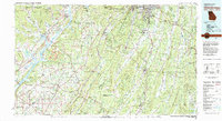
1981 Map of Chickamauga
USGS Topo · Published 1982About this map
Chickamauga and Chattanooga National Military Park anchors this tri-state region, marking a landscape defined by the parallel ridges of Lookout Mountain, Pigeon Mountain, and Taylor Ridge. The Tennessee River winds through the northwest, widening into Guntersville Lake and Nickajack Lake as it bypasses Bridgeport. The map illustrates the complex transportation network of the early 1980s, where the Southern and Central of Georgia railroads intersect with major thoroughfares like I-75 and Us 27. Cultural and recreational sites are prominent, from the high terrain of Cloudland Canyon State Park to the valley towns of LaFayette, Chickamauga, and Trion. This survey documents the intersection of Civil War history and modern infrastructure across North Georgia, Northeast Alabama, and Southeast Tennessee.
Find a feature on this map
47 named features on this map. Tap any name to fly to it.
Don’t see what you’re looking for? This feature index may not catch every label — zoom into the map to look around manually.
Map Details
Editions of this 1981 Chickamauga Map
2 editions found
Other maps of this area

1885 · Gadsden
USGS Topo · 1:125,000

1886 · Dalton
USGS Topo · 1:125,000

1886 · Cleveland
USGS Topo · 1:125,000

1886 · Ringgold
USGS Topo · 1:125,000

1886 · Rome
USGS Topo · 1:125,000

1886 · Stevenson
USGS Topo · 1:125,000

1888 · Gadsden
USGS Topo · 1:125,000

1888 · Chattanooga
USGS Topo · 1:125,000

1888 · Scottsboro
USGS Topo · 1:125,000

1890 · Cartersville
USGS Topo · 1:125,000