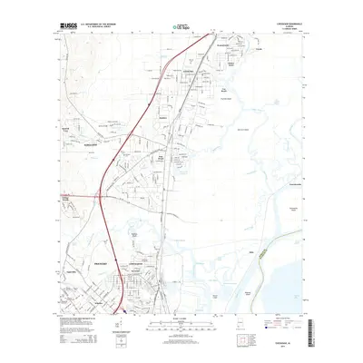
2014 Map of Chickasaw
USGS Topo · Published 2014About this map
The industrial and riverfront landscape of northern Mobile County is defined by the convergence of the Mobile River and Spanish River in this 2014 study. Industrial growth is evident in the corridors surrounding Chickasaw and Prichard, where the complex rail and road networks of Gulf St and Highway 43 S intersect. The map reveals the intricate delta environment east of Satsuma, featuring a maze of waterways like Big Bayou Canot and Hickory Bayou surrounding Twelvemile Island. Genealogists will find a high concentration of local burial sites throughout the residential areas, including Whistler Colored Cem, Pritchard Memorial Cem, and Satsuma Cem. This record of the coastal Alabama interior balances the expansion of suburban neighborhoods like Norwood and Junior Acres against the persistent marshlands of the lower river basin.
Find a feature on this map
71 named features on this map. Tap any name to fly to it.
Don’t see what you’re looking for? This feature index may not catch every label — zoom into the map to look around manually.
Map Details
Editions of this 2014 Chickasaw Map
This is the sole edition of this map. No revisions or reprints were ever made.
Other maps of this area

1921 · Fairhope
USGS Topo · 1:62,500

1922 · Mobile
USGS Topo · 1:62,500

1940 · Mobile
USGS Topo · 1:31,680

1940 · Mobile
USGS Topo · 1:62,500

1941 · Chickasaw
USGS Topo · 1:31,680

1941 · Blakeley
USGS Topo · 1:31,680

1941 · Bay Minette
USGS Topo · 1:62,500

1941 · Creola
USGS Topo · 1:62,500

1941 · Fairhope
USGS Topo · 1:62,500

1942 · Hurricane
USGS Topo · 1:31,680