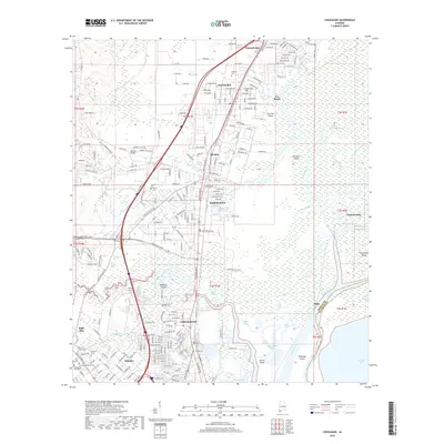
2018 Map of Chickasaw
USGS Topo · Published 2018About this map
Chickasaw and Saraland anchor this 2018 survey of the northern Mobile suburbs, a landscape defined by the transition from industrial corridors to the vast wetlands of the Mobile River delta. The Southern Ry and major transit routes like Industrial Pkwy bisect the developed western ridge, while the eastern half of the map dissolves into a complex network of waterways including Bayou Sara, Chickasaw Creek, and the Mobile River. These tidally influenced channels isolate numerous named landforms such as Robbers Island and Blakeley Island.
Find a feature on this map
60 named features on this map. Tap any name to fly to it.
Don’t see what you’re looking for? This feature index may not catch every label — zoom into the map to look around manually.
Map Details
Editions of this 2018 Chickasaw Map
This is the sole edition of this map. No revisions or reprints were ever made.
Other maps of this area

1921 · Fairhope
USGS Topo · 1:62,500

1922 · Mobile
USGS Topo · 1:62,500

1940 · Mobile
USGS Topo · 1:31,680

1940 · Mobile
USGS Topo · 1:62,500

1941 · Chickasaw
USGS Topo · 1:31,680

1941 · Blakeley
USGS Topo · 1:31,680

1941 · Bay Minette
USGS Topo · 1:62,500

1941 · Creola
USGS Topo · 1:62,500

1941 · Fairhope
USGS Topo · 1:62,500

1942 · Hurricane
USGS Topo · 1:31,680