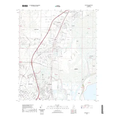
2020 Map of Chickasaw
USGS Topo · Published 2020About this map
Chickasaw and Saraland anchor this 2020 layout, showcasing the dense residential and industrial corridors north of the city of Mobile. The landscape is a complex network of bayous and islands, where the Mobile River and Spanish River create a labyrinth of wetlands. These waterways, including Chickasaw Creek and Bayou Sara, have long defined the transit and economy of the region. Local history is preserved in several significant burial grounds such as Whistler Cem and Satsuma Cem, which serve as quiet landmarks amidst the growing suburban sprawl of Prichard and Satsuma. The map reveals the intricate drainage patterns around Saraland Reservoir and the numerous low-lying islands like Blakeley Island and Robbers Island that separate the urbanized mainland from the river delta.
Find a feature on this map
148 named features on this map. Tap any name to fly to it.
Don’t see what you’re looking for? This feature index may not catch every label — zoom into the map to look around manually.
Map Details
Editions of this 2020 Chickasaw Map
This is the sole edition of this map. No revisions or reprints were ever made.
Other maps of this area

1921 · Fairhope
USGS Topo · 1:62,500

1922 · Mobile
USGS Topo · 1:62,500

1940 · Mobile
USGS Topo · 1:31,680

1940 · Mobile
USGS Topo · 1:62,500

1941 · Chickasaw
USGS Topo · 1:31,680

1941 · Blakeley
USGS Topo · 1:31,680

1941 · Bay Minette
USGS Topo · 1:62,500

1941 · Creola
USGS Topo · 1:62,500

1941 · Fairhope
USGS Topo · 1:62,500

1942 · Hurricane
USGS Topo · 1:31,680