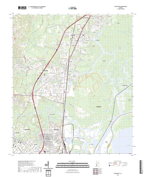
2024 Map of Chickasaw
USGS Topo · Published 2024About this map
Mobile and its northern industrial suburbs meet the intricate delta of the Mobile River on this modern study. The urban centers of Chickasaw, Prichard, and Saraland contrast with the dense marshlands and winding waterways to the east. This landscape is defined by the heavy presence of the river-and-bayou system, including Bayou Sara and Chickasaw Creek, which separate the mainland settlements from a series of riverine islands such as Blakeley Island and Twelvemile Island. Genealogical interest is concentrated in the numerous burial grounds documented here, including Whistler Cem and Satsuma Cem. The map also preserves the memory of historic river crossings with labels for Alvares Ferry and Clevelands Ferry. Inland, the terrain is shaped by modern infrastructure like I-65 and Saraland Blvd S, while the Saraland Reservoir stands as a notable water management feature near the heart of the community.
Find a feature on this map
72 named features on this map. Tap any name to fly to it.
Don’t see what you’re looking for? This feature index may not catch every label — zoom into the map to look around manually.
Map Details
Editions of this 2024 Chickasaw Map
This is the sole edition of this map. No revisions or reprints were ever made.
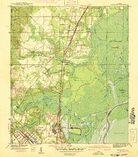
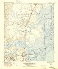
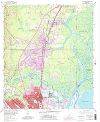
Historical Maps of Pine Wood Through Time
4 maps found