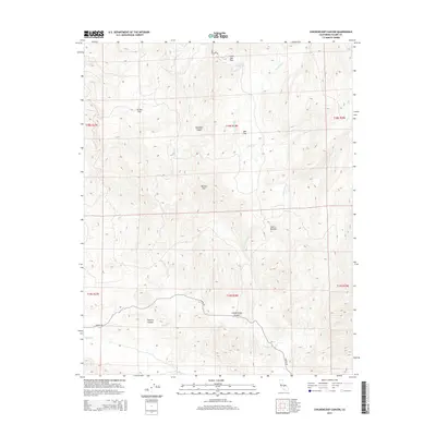
2015 Map of Chickencoop Canyon
USGS Topo · Published 2015About this map
Chickencoop Canyon and Franklin Canyon dominate the lower half of this central Tulare County landscape, where the foothills of the Sierra Nevada begin their ascent. The area is defined by a series of steep drainage systems, including Yokohl Cr, Horse Cr, and Wells Cr, which carve through the terrain between prominent landmarks like Potato Hill. Human development is concentrated along the southern corridor, where Yokohl Dr provides the primary access route through the canyons. Notable high-ground areas such as Jordan Flat, Oak Flat, and Little Oak Flat suggest pockets of level terrain amidst the otherwise vertical landscape. The map captures the interface between the valley floor drainage and the mountain foothills, illustrating the network of creeks that feed into the larger Yokohl Creek watershed.
Find a feature on this map
22 named features on this map. Tap any name to fly to it.
Don’t see what you’re looking for? This feature index may not catch every label — zoom into the map to look around manually.
Map Details
Editions of this 2015 Chickencoop Canyon Map
This is the sole edition of this map. No revisions or reprints were ever made.
Other maps of this area

1904 · Kaweah
USGS Topo · 1:125,000

1909 · Kaweah
USGS Topo · 1:125,000

1925 · Rocky Hill
USGS Topo · 1:31,680

1927 · Rocky Hill
USGS Topo · 1:31,680

1928 · Lemon Cove
USGS Topo · 1:31,680

1928 · Lindsay
USGS Topo · 1:31,680

1937 · Kaweah
USGS Topo · 1:125,000
1942 · Porterville
USGS Topo · 1:62,500

1948 · Fresno
USGS Topo · 1:250,000
1951 · Rocky Hill
USGS Topo · 1:24,000