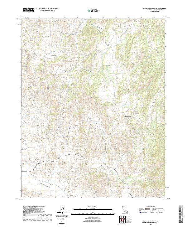
2021 Map of Chickencoop Canyon
USGS Topo · Published 2021About this map
The foothills of the Sierra Nevada define this region of Tulare County, where narrow drainages and named flats break the ascending terrain. The southwestern corner is dominated by the relatively open Yokohl Valley, which is accessed by Yokohl Dr and drained by the seasonal Yokohl Cr. The landscape transitions from these valley floors into a series of north-south running ridges and canyons, most notably Chickencoop Canyon and Franklin Canyon.
Find a feature on this map
23 named features on this map. Tap any name to fly to it.
Don’t see what you’re looking for? This feature index may not catch every label — zoom into the map to look around manually.
Map Details
Editions of this 2021 Chickencoop Canyon Map
This is the sole edition of this map. No revisions or reprints were ever made.
Other maps of this area

1904 · Kaweah
USGS Topo · 1:125,000

1909 · Kaweah
USGS Topo · 1:125,000

1925 · Rocky Hill
USGS Topo · 1:31,680

1927 · Rocky Hill
USGS Topo · 1:31,680

1928 · Lemon Cove
USGS Topo · 1:31,680

1928 · Lindsay
USGS Topo · 1:31,680

1937 · Kaweah
USGS Topo · 1:125,000
1942 · Porterville
USGS Topo · 1:62,500

1948 · Fresno
USGS Topo · 1:250,000
1951 · Rocky Hill
USGS Topo · 1:24,000