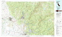
1980 Map of Chico
USGS Topo · Published 1980About this map
Chico and the surrounding Butte County foothills are captured here during a period of significant regional development in the late 1970s. The landscape transition from the Sacramento Valley floor into the Sierra Nevada is clearly visible, anchored by the urban centers of Chico and Paradise. To the west, the winding path of the Sacramento River defines the edge of historic land grants like Rancho de Farwell and Rancho Arroyo Chico, where orchards and agriculture dominate the level plains. To the east, the terrain rises sharply along the Cohasset Ridge and Doe Mill Ridge, leading into the timberlands of the Lassen National Forest and Plumas National Forest. The map documents the extensive water management systems of the era, including the sprawling Lake Oroville and the Thermalito Afterbay. Smaller, historically rich settlements such as Magalia, Cherokee, and the mountain community of Stirling City are mapped alongside the industrial infrastructure of the Southern Pacific and Western Pacific railroads.
Find a feature on this map
90 named features on this map. Tap any name to fly to it.
Don’t see what you’re looking for? This feature index may not catch every label — zoom into the map to look around manually.
Map Details
Editions of this 1980 Chico Map
2 editions found
Other maps of this area

1886 · Honey Lake
USGS Topo · 1:250,000

1886 · Lassen Peak
USGS Topo · 1:250,000

1888 · Marysville
USGS Topo · 1:125,000

1888 · Smartsville
USGS Topo · 1:125,000

1888 · Bidwell Bar
USGS Topo · 1:125,000

1890 · Red Bluff
USGS Topo · 1:250,000

1891 · Bidwell Bar
USGS Topo · 1:125,000

1891 · Chico
USGS Topo · 1:125,000

1891 · Downieville
USGS Topo · 1:125,000

1891 · Honey Lake
USGS Topo · 1:250,000