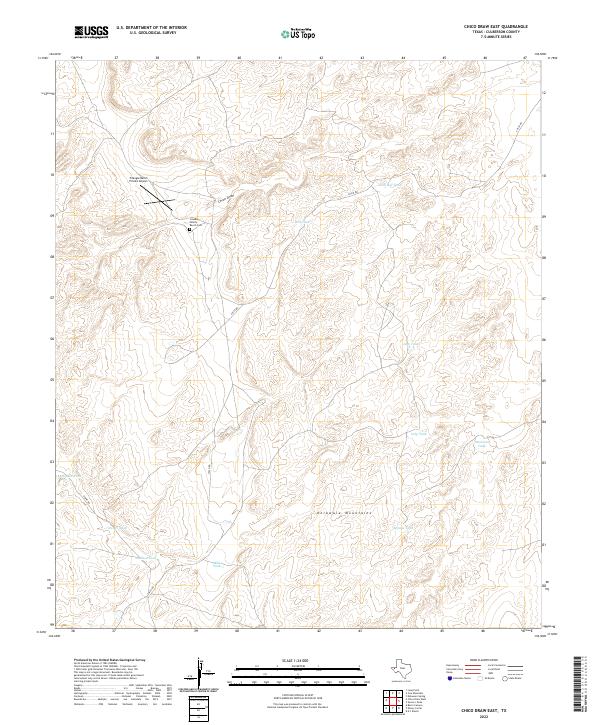
2022 Map of Chico Draw East
USGS Topo · Published 2022About this map
The Delaware Mountains form the topographic spine of this West Texas landscape, where life and transit are defined by the management of water in an arid environment. A network of catchments, including Red Tank, Nob Hill Tank, and Patterson Tank, is distributed across the terrain, supporting the ranching operations that characterize Culberson County. Near the head of Chico Draw, the Cowden Family Ranch Cem provides a specific point of interest for genealogists tracing the legacy of local ranching families. The presence of the Triangle Ranch Private Airport and a series of unpaved tracks like Chico Rd and Stone Rd reflect the remote infrastructure required to navigate and maintain these large landholdings. This survey documents the intersection of natural relief and the practical adaptations of high-desert ranching life.
Find a feature on this map
16 named features on this map. Tap any name to fly to it.
Don’t see what you’re looking for? This feature index may not catch every label — zoom into the map to look around manually.
Map Details
Editions of this 2022 Chico Draw East Map
This is the sole edition of this map. No revisions or reprints were ever made.
Other maps of this area

1954 · Van Horn
USGS Topo · 1:250,000

1958 · Van Horn
USGS Topo · 1:250,000

1973 · Seven L Peak
USGS Topo · 1:24,000

1973 · K C Ranch
USGS Topo · 1:24,000

1973 · Chico Draw East
USGS Topo · 1:24,000

1973 · Cow Mountain
USGS Topo · 1:24,000

1973 · Burro Canyon
USGS Topo · 1:24,000

1973 · Delaware Spring
USGS Topo · 1:24,000
1973 · Emory Corral
USGS Topo · 1:24,000
1973 · Long Point
USGS Topo · 1:24,000