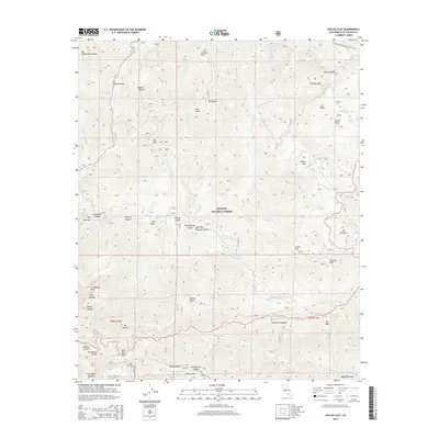
2015 Map of Chilao Flat
USGS Topo · Published 2015About this map
The San Gabriel Mountains dominate this high-altitude survey of the Angeles National Forest, centering on the flat-bottomed basins that historically served as hubs for pack travel and early mountain recreation. Chilao Flat and Charlton Flat appear as distinct plateaus amidst a complex network of steep drainages, including Big Tujunga Canyon and the headwaters of the W Fork San Gabriel River. The landscape is defined by its prominent summits, such as Strawberry Peak and Mt Hillyer, which offer natural orientation points within the rugged backcountry.
Find a feature on this map
55 named features on this map. Tap any name to fly to it.
Don’t see what you’re looking for? This feature index may not catch every label — zoom into the map to look around manually.
Map Details
Editions of this 2015 Chilao Flat Map
This is the sole edition of this map. No revisions or reprints were ever made.
Other maps of this area

1894 · Los Angeles
USGS Topo · 1:62,500

1894 · Pomona
USGS Topo · 1:62,500

1896 · Pasadena
USGS Topo · 1:62,500

1897 · Pomona
USGS Topo · 1:62,500

1898 · Pomona
USGS Topo · 1:62,500

1900 · Pasadena
USGS Topo · 1:62,500

1900 · Tujunga
USGS Topo · 1:62,500

1900 · Los Angeles
USGS Topo · 1:62,500

1901 · Southern California Sheet No. 1
USGS Topo · 1:250,000

1903 · Rock Creek
USGS Topo · 1:62,500