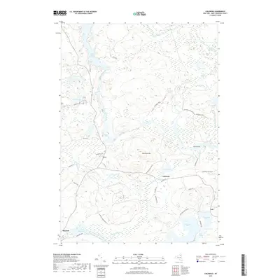
2019 Map of Childwold
USGS Topo · Published 2019About this map
Childwold and Sevey anchor this landscape within the northern reaches of the Adirondack Park. The terrain is defined by a complex network of waterways, most notably the winding course of the Raquette River as it flows north toward the Carry Falls Reservoir. Along its path, the river encounters natural obstructions like Jamestown Falls, Moody Falls, and Moosehead Rapids, which illustrate the drop in elevation around Moosehead Mtn. To the east, the Jordan River feeds into a series of wetlands including Salisbury Marsh. The southern portion of the sheet reveals a high concentration of glacial ponds and lakes, including Massawepie Lake and Catamount Pond. This region, heavily protected as part of the Adirondack Park Preserve, shows a transition from the managed waters of the reservoir to the more secluded brook-and-pond systems like Jocks Pond and Windfall Pond.
Find a feature on this map
42 named features on this map. Tap any name to fly to it.
Don’t see what you’re looking for? This feature index may not catch every label — zoom into the map to look around manually.
Map Details
Editions of this 2019 Childwold Map
This is the sole edition of this map. No revisions or reprints were ever made.
Other maps of this area

1907 · Tupper Lake
USGS Topo · 1:62,500

1919 · Cranberry Lake
USGS Topo · 1:62,500

1920 · Childwold
USGS Topo · 1:62,500

1921 · Cranberry Lake
USGS Topo · 1:62,500

1921 · Childwold
USGS Topo · 1:48,000

1921 · Stark
USGS Topo · 1:62,500

1922 · Childwold
USGS Topo · 1:62,500

1923 · Stark
USGS Topo · 1:62,500

1931 · Cranberry Lake
USGS Topo · 1:62,500

1940 · Stark
USGS Topo · 1:62,500