2022 Map of Chilton
USGS Topo · Published 2022About this map
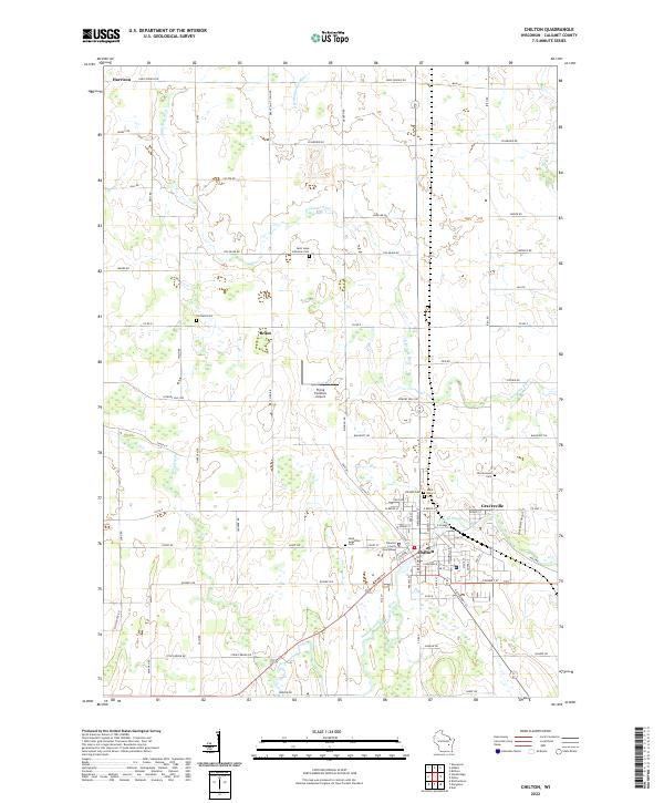
The Calumet County Courthouse serves as the focal point of Chilton, the primary seat of local government and commerce in this portion of eastern Wisconsin. The town is situated at the confluence where the South Branch Manitowoc River joins the main waterway, with residential and commercial streets concentrated south of the riverbend. To the northeast, the smaller settlement of Gravesville borders the river, while the surrounding countryside is defined by a dense network of family-owned farm plots and rural cemeteries. Long-standing local burial sites such as Saint Mary's Cem and Charlestown Cem are scattered across the township, marking the heritage of the early families who established these communities. The terrain is relatively flat, facilitating the development of the Flying Feathers Airport and an extensive grid of local roads like Bancroft Rd and Killsnake Rd that connect outlying hamlets like Brant and Harrison to the county seat.
Find a feature on this map
94 named features on this map. Tap any name to fly to it.
Don’t see what you’re looking for? This feature index may not catch every label — zoom into the map to look around manually.
Map Details
Editions of this 2022 Chilton Map
This is the sole edition of this map. No revisions or reprints were ever made.
Historical Maps of Harrison Through Time
4 maps found