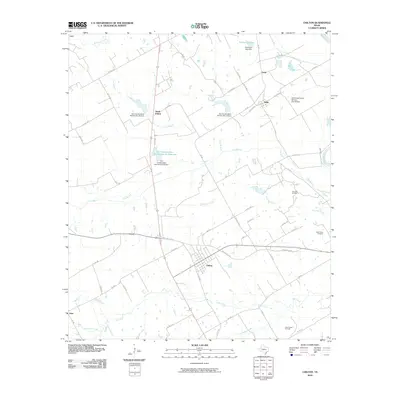
2010 Map of Chilton
USGS Topo · Published 2010About this map
The town of Chilton serves as the central hub of this central Texas landscape, situated at a junction where local roads branch out toward smaller outlying settlements like Satin, North Prairie, and Levi. The eastern boundary is defined by the winding course of the Brazos River, while the interior terrain is marked by an extensive system of water management. Numerous dams and reservoirs, such as the Soil Conservation Service Site 30 Reservoir and Tomlinson Lake Dam, illustrate the 21st-century focus on flood control and water conservation within the watershed of Cow Bayou and Deer Creek. Local industry and history are evident in the presence of the Post Oak Oil Field and the Deer Creek Oil Field, as well as the Cedar Valley Cemetery, providing important markers for genealogists and researchers tracking family roots in Falls County.
Find a feature on this map
67 named features on this map. Tap any name to fly to it.
Don’t see what you’re looking for? This feature index may not catch every label — zoom into the map to look around manually.
Map Details
Editions of this 2010 Chilton Map
This is the sole edition of this map. No revisions or reprints were ever made.
Other maps of this area

1892 · Temple
USGS Topo · 1:125,000

1954 · Waco
USGS Topo · 1:250,000

1955 · Waco
USGS Topo · 1:250,000

1957 · Bruceville
USGS Topo · 1:24,000

1957 · Lorena
USGS Topo · 1:24,000

1957 · Riesel
USGS Topo · 1:24,000

1957 · Chilton
USGS Topo · 1:24,000

1957 · Marlin
USGS Topo · 1:24,000
1957 · Robinson
USGS Topo · 1:24,000

1962 · Cedar Springs
USGS Topo · 1:24,000