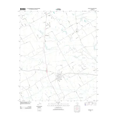
2012 Map of Chilton
USGS Topo · Published 2012About this map
The settlement of Chilton serves as the primary hub of this central Texas landscape, situated at the junction of several rural routes including FM 107. The area is defined by a dendritic network of creeks and bayous, most notably Cow Bayou and Deer Cr, which drain toward the Brazos River at the eastern edge of the quadrangle. Local industry and land use are clearly visible through the presence of the Post Oak Oil Field and Deer Creek Oil Field, indicating the importance of energy extraction alongside traditional agriculture.
Find a feature on this map
96 named features on this map. Tap any name to fly to it.
Don’t see what you’re looking for? This feature index may not catch every label — zoom into the map to look around manually.
Map Details
Editions of this 2012 Chilton Map
This is the sole edition of this map. No revisions or reprints were ever made.
Other maps of this area

1892 · Temple
USGS Topo · 1:125,000

1954 · Waco
USGS Topo · 1:250,000

1955 · Waco
USGS Topo · 1:250,000

1957 · Bruceville
USGS Topo · 1:24,000

1957 · Lorena
USGS Topo · 1:24,000

1957 · Riesel
USGS Topo · 1:24,000

1957 · Chilton
USGS Topo · 1:24,000

1957 · Marlin
USGS Topo · 1:24,000
1957 · Robinson
USGS Topo · 1:24,000

1962 · Cedar Springs
USGS Topo · 1:24,000