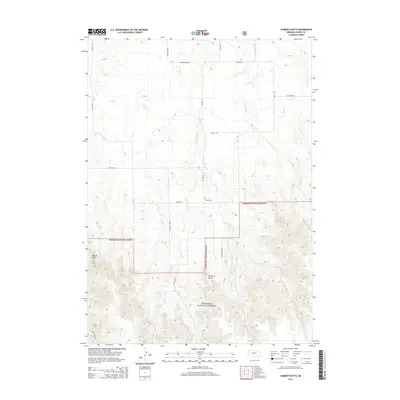
2014 Map of Chimney Butte
USGS Topo · Published 2014About this map
The Nebraska National Forest dominates the southern half of this landscape, where the terrain rises sharply into the prominent elevations of Chimney Butte and Barrel Butte. This 2014 survey documents a network of rural routes and drainage systems that define the area's geography, including the convergence of Trunk Butte Cr and Indian Cr. The land use pattern transitions from these forested heights toward open range and ranch land to the north, navigated by gravel and local roads like Bethel Rd and Faulk Rd.
Find a feature on this map
21 named features on this map. Tap any name to fly to it.
Don’t see what you’re looking for? This feature index may not catch every label — zoom into the map to look around manually.
Map Details
Editions of this 2014 Chimney Butte Map
This is the sole edition of this map. No revisions or reprints were ever made.
Other maps of this area

1955 · Alliance
USGS Topo · 1:250,000

1957 · Alliance
USGS Topo · 1:250,000

1958 · Alliance
USGS Topo · 1:250,000

1980 · Crow Butte
USGS Topo · 1:24,000
1980 · Coffee Mill Butte SE
USGS Topo · 1:24,000
1980 · Coffee Mill Butte
USGS Topo · 1:24,000
1980 · Coffee Mill Butte SW
USGS Topo · 1:24,000
1980 · Trunk Butte
USGS Topo · 1:24,000
1980 · Chimney Butte
USGS Topo · 1:24,000
1980 · Belmont
USGS Topo · 1:24,000