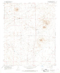
1967 Map of Chimney Butte
USGS Topo · Published 1969About this map
Navajo Indian Reservation lands dominate this high-desert landscape, where isolated geological formations define the topography. The terrain is marked by distinctive prominences including the central Chimney Butte, Red Cheek Butte to the northeast, and the well-defined Pyramid Butte in the northwest. These landmarks served as vital orientation points for travelers and residents within the reservation.
Find a feature on this map
15 named features on this map. Tap any name to fly to it.
Don’t see what you’re looking for? This feature index may not catch every label — zoom into the map to look around manually.
Map Details
Editions of this 1967 Chimney Butte Map
This is the sole edition of this map. No revisions or reprints were ever made.
Other maps of this area

1883 · Tusayan
USGS Topo · 1:250,000

1886 · Tusayan
USGS Topo · 1:250,000

1947 · Flagstaff
USGS Topo · 1:250,000

1954 · Winslow
USGS Topo · 1:62,500

1954 · Winslow 4 NE
USGS Topo · 1:24,000

1954 · Flagstaff
USGS Topo · 1:250,000

1958 · Flagstaff
USGS Topo · 1:250,000

1960 · Flagstaff
USGS Topo · 1:250,000

1962 · Flagstaff
USGS Topo · 1:250,000
1967 · Dilkon
USGS Topo · 1:24,000